Before interactive whiteboards or glowing tablets, generations of Canadian students learned about their place in the world by watching a teacher pull down a heavy canvas roll over the blackboard. For decades, one such map hung inside the old schoolhouse in Melgund Township—a silent witness to arithmetic lessons, recess bells, and the changing landscape of Northwestern Ontario. Long after the building transitioned into the Dyment Recreation Hall, that very map remained tucked away, out of sight and quietly gathering age.
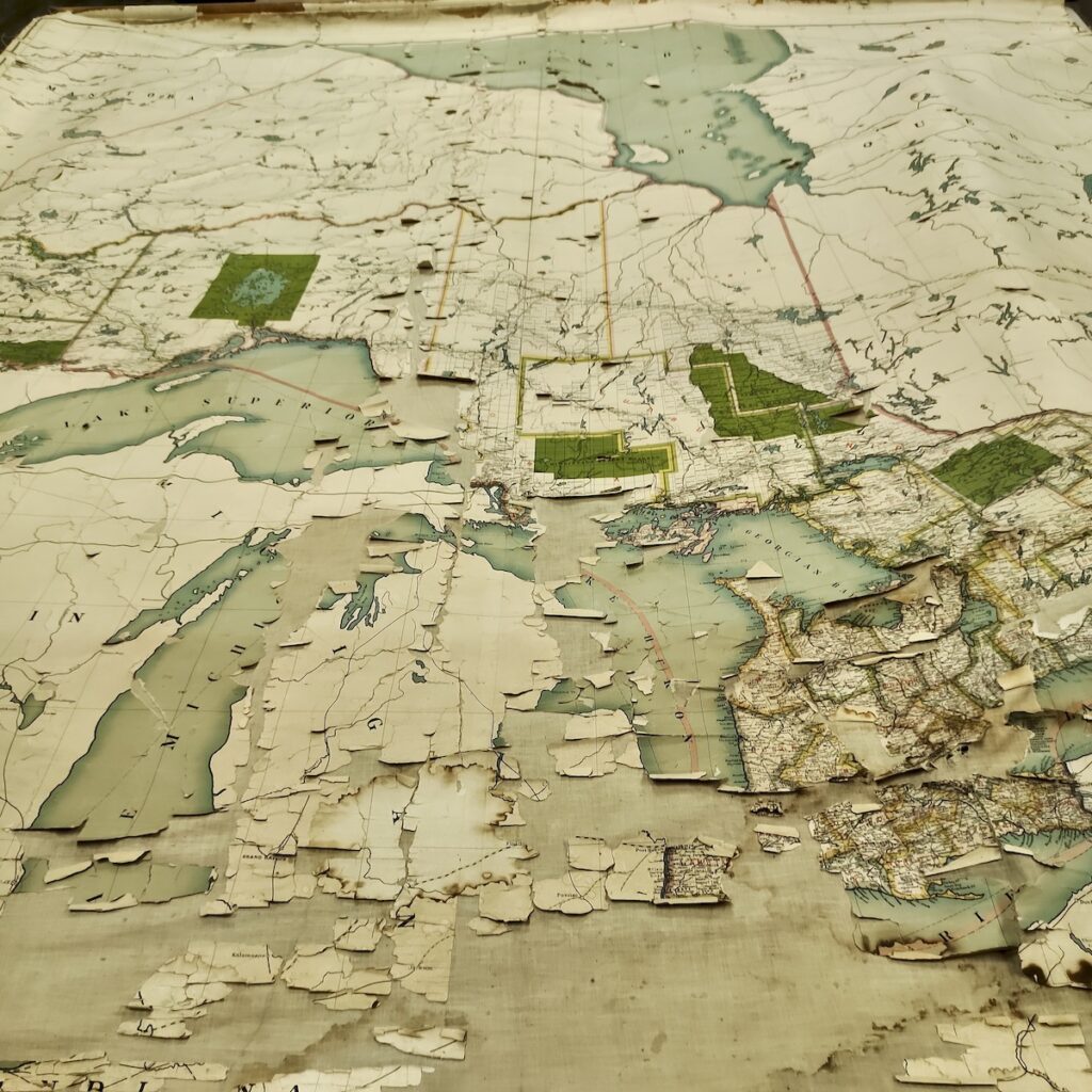
Recently, we finally rolled it out across the tables to take a good, hard look. The immediate reaction? Pure awe, mixed with a healthy dose of reverence for a piece of history that has survived against the odds. Printed on paper and fused onto a heavy linen-canvas backing, the map shows the telltale signs of spending decades in uninsulated storage. Years of temperature swings dried out the glue, causing sections of paper to crack, flake, and lift like autumn leaves. Yet, despite its fragile state, the craftsmanship and vivid details still jump right off the table.
Looking closely at the typography and layout offers a fascinating window into turn-of-the-century geography. The map was distributed by the E.N. Moyer Company—a powerhouse of Canadian educational supplies based out of Toronto, Winnipeg, and Edmonton during Canada’s rapid western expansion between 1890 and 1915. The actual cartography, however, made a journey across the Atlantic. It was lithographed by London’s legendary George Philip & Son as part of their famous “Empire Series,” designed specifically to standardise geography lessons for classrooms across the Commonwealth.
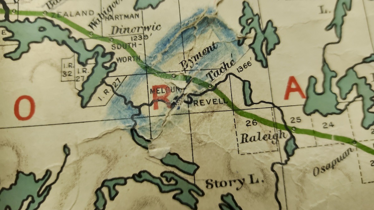
What makes this rollout particularly exciting for local history buffs is how finely detailed the local canvas is. You can trace early township boundary lines printed in stark black ink alongside red district labels. Zooming into our corner of Northwestern Ontario reveals familiar local names like Dyment, Taché, Revell, and Wabigoon standing proud along railway lines and elevation markers. It is a snapshot of an era when local survey lines were being carved out and townships were taking shape in real-time.
While time and humidity have certainly left their mark, this isn’t the end of the road for our classroom artifact. Rediscovering the map is just step one. Moving forward, we are exploring options to carefully stabilize the cracking paper backing, prevent further loss, and ensure this piece of Dyment’s heritage remains preserved for future generations to explore. It’s a delicate puzzle, but one well worth solving.