
Executive Summary
The inclusion of Indigenous peoples beyond the immediate “host” communities is a critical regulatory and constitutional requirement for the Revell Site Deep Geological Repository (DGR). The project is situated within Treaty #3 territory, yet its potential impacts extend across vast transboundary watersheds and thousands of kilometers of transportation corridors [Ref: 705, 485]. Evidence from the public registry indicates that the current “host-centric” model employed by the Nuclear Waste Management Organization (NWMO) fails to account for unresolved land claims, the “chilling effect” on harvesting rights along Highway 17, and the national government status of nations like the Red River Métis [Ref: 517, 624]. Technical analysis reveals that the proponent’s reliance on a narrow geographic scope ignores the interconnectedness of the boreal ecosystem and the inherent sovereignty of Indigenous nations whose traditional lands are bisected by the project’s logistics network [Analysis: Acknowledgment of Truths].
Detailed Analysis of Indigenous Inclusion and Transboundary Issues
Jurisdictional Authority and Unresolved Land Claims
The Grand Council Treaty #3 (GCT3) asserts that the project is proposed within their territory and that the current process ignores the Crown’s constitutional duties [Ref: 705]. A primary concern is the disregard for Manito Aki Inaakonigewin (MAI), the Nation’s traditional laws regarding land and resource development [Ref: 660]. The Eagle Lake First Nation (ELFN) has initiated legal action, asserting that the project is located within their territory and they have been improperly denied recognition as a host community [Ref: 28]. This jurisdictional conflict creates significant legal risk, as the proponent is alleged to be taking positions on Section 35 rights that are outside its authority [Ref: 705].
Transboundary Watershed and Ecosystem Risks
The Revell site sits at the headwaters of the Wabigoon and Rainy/Turtle River watersheds, which drain into Manitoba via Lake of the Woods and Lake Winnipeg [Ref: 112, 392]. The Manitoba Métis Federation (MMF) and the Nishnawbe Aski Nation (NAN) have raised alarms regarding downstream effects on water quality and the safety of harvested wildlife [Ref: 517, 485]. The MMF emphasizes that the perception of contamination can lead to “behavior modification,” where citizens avoid traditional harvesting areas, impacting mental wellness and cultural connection to the land [Ref: 517]. The transboundary nature of these risks means that a failure in containment could impact property owners and Indigenous harvesters in Manitoba and the United States [Ref: 112].
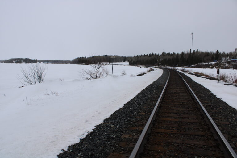
Transportation Corridors and the “Chilling Effect”
The exclusion of the 50-year transportation phase from the Initial Project Description is viewed as a strategic move to limit Indigenous input [Ref: 350]. NAN argues that transporting 5.9 million fuel bundles over thousands of kilometers will have a “chilling effect” on the ability of member First Nations to exercise their treaty rights along the Highway 11 and Highway 17 corridors [Ref: 485]. The Passamaquoddy Recognition Group also asserts that the project intersects with unceded territory and rights without Free, Prior, and Informed Consent (FPIC), labeling the movement of waste across Indigenous lands as “environmental racism” [Ref: 655].
Evidence from the Public Registry
- Grand Council Treaty #3: Claims the IAAC Summary of Issues fails to incorporate their specific legal and jurisdictional concerns and ignores the Crown’s duty to harmonize traditional laws with the Impact Assessment Act [Ref: 705].
- Manitoba Métis Federation: Rejects the “pan-Indigenous” approach and demands distinction-based engagement, noting that the Red River Métis Homeland will be impacted by downstream effects and cumulative industrial development [Ref: 517].
- Nishnawbe Aski Nation: Maintains firm opposition, viewing the burial of waste as a betrayal of their mandate as stewards of the land and water [Ref: 485].
- Iskatewizaagegan No. 39 Independent First Nation: Declares non-consent, arguing that the “taking up” of land threatens Indigenous existence and lacks standards to safeguard inherent rights [Ref: 624].
Technical Deficiencies & Gaps
Internal analysis identifies a “geographic framing strategy” that systematically marginalizes Indigenous nations not designated as “hosts” [Analysis: Acknowledgment of Truths]. The proponent admits that the data in the Initial Project Description is not a full representation of Indigenous identity for populations in unincorporated communities or on-reserve [Analysis: 15.5 Population and Demographics]. This data gap undermines the “informed” nature of consent. Furthermore, the proponent’s reliance on a 160-year regulatory lifecycle is described as a profound spiritual and practical issue for the Anishinaabe, who intend to remain on the land indefinitely, far outlasting the toxic life of the fuel [Ref: 660]. The exclusion of off-site transportation from the project scope prevents a holistic evaluation of impacts on harvesting, land use, and the intergenerational transfer of risk [Analysis: 4.5 Plan for Future Public and Interested Parties Engagement].
Recommendations & Mandates
- Strongly recommend that the proponent establish a transparent, legally binding framework defining how Anishinaabe Values and Indigenous Knowledge will practically override or modify engineering requirements in the safety case [Analysis: Acknowledgment of Truths].
- Strongly recommend the completion of Indigenous-led socio-economic and health baseline studies for all potentially affected nations, ensuring these studies are owned and controlled by the communities to respect data sovereignty [Analysis: 15.9 Economic Conditions].
- Strongly recommend that the proponent develop a “Trans-Jurisdictional Transportation Risk Integration Plan” that includes all Indigenous nations along the Highway 17 and rail corridors in the formal consent and mitigation framework [Analysis: Executive Summary – Initial Project Description Conclusions].
- Strongly recommend the establishment of a permanent, well-funded Indigenous-led Oversight Body with the authority to pause operations if cultural or environmental thresholds are breached [Analysis: 4. Building Relationships].
Conclusion
The failure to include other Indigenous peoples in the Revell DGR assessment represents a fundamental breakdown in regulatory consultation and reconciliation. The project’s risks are not confined to the 340-hectare surface site; they permeate the watersheds and transportation arteries that sustain Indigenous life across provincial boundaries. Without addressing unresolved land claims and the cumulative impacts on traditional land use, the project lacks the necessary social and legal license to proceed. A shift from a “host-centric” model to a nation-to-nation co-management framework is the only viable path forward to ensure the long-term safety and integrity of the territory.
About the Deep Geological Repository (DGR) for Canada’s Used Nuclear Fuel Project
The Nuclear Waste Management Organization (the NWMO) is proposing a new underground deep geological repository system designed to safely contain and isolate used nuclear fuel. Wabigoon Lake Ojibway Nation (WLON) and the Township of Ignace have been selected as the host communities for the proposed project, which is located 21 kilometres southeast of the WLON and 43 kilometres northwest of the Town of Ignace, Ontario along Highway 17. As proposed, the Deep Geological Repository (DGR) for Canada’s Used Nuclear Fuel Project would provide permanent storage for approximately 5.9 million bundles of used nuclear fuel. The project is expected to span approximately 160 years, encompassing site preparation, construction, operation and closure monitoring. The project assessment is being conducted in collaboration with the Canadian Nuclear Safety Commission.
Learn more about the Integrated Impact Assessment process which is led by the Impact Assessment Agency of Canada and Canadian Nuclear Safety Commission.
- Read the Summary of Issues (February 16, 2026)
- Read the Summary of the Initial Project Description (January 5, 2026)
- Read the Initial Project Description (January 5, 2026)
- Learn More about the Melgund Integrated Nuclear Impact Assessment (MINIA) Project
- Learn More about the Nuclear Waste Management Organization (NWMO)