Executive Summary
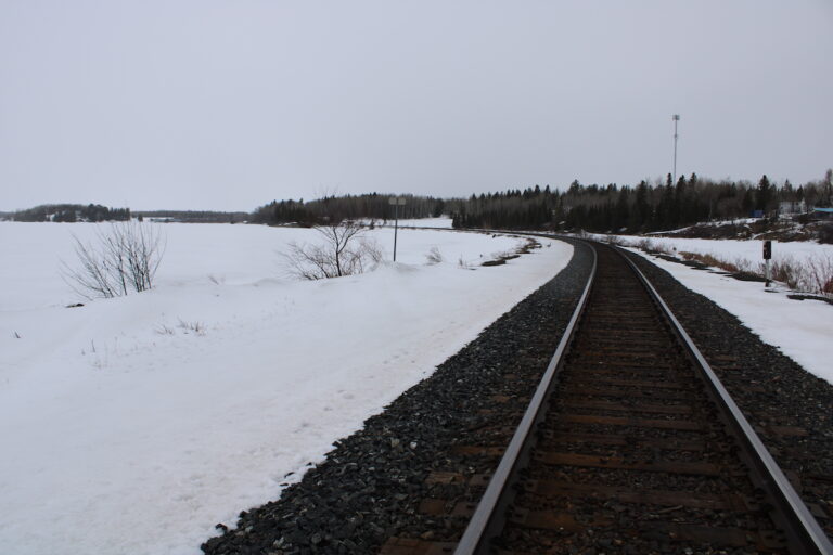
The Initial Project Description (IPD) for the Revell Site Deep Geological Repository (DGR) faces significant criticism regarding the adequacy, currency, and site-specificity of its baseline studies. Key concerns center on the Nuclear Waste Management Organization’s (NWMO) reliance on distant meteorological data, statistically insufficient hydrogeological sampling, and outdated regional studies for traditional foods and socio-economic conditions. Furthermore, the admission that Indigenous health and social data remain uncharacterized undermines the proponent’s claims of ‘informed’ consent. The Revell site and Melgund Township, situated in unorganized territories directly along the Trans-Canada Highway (Highway 17), lack the municipal infrastructure to absorb the risks identified in these deficient baselines.
Detailed Analysis
Biophysical and Meteorological Data Gaps
A primary technical deficiency is the NWMO’s reliance on the Dryden meteorological station, located approximately 55 km northwest of the Project site, to establish climate normals [Analysis: 14. Biophysical Environment]. In the rugged topography of the Canadian Shield, this distance introduces substantial uncertainty regarding micro-climatic variability, wind patterns, and localized precipitation—factors critical for modeling atmospheric dispersion and surface water runoff. While an on-site station was established in 2021, it has suffered from power failures and temporal data gaps, particularly in February 2023 [Analysis: 14. Biophysical Environment]. Furthermore, the snowfall data appears to underestimate total winter precipitation, with zero precipitation recorded in December 2023 despite 67 cm of snow accumulation, suggesting a failure to accurately record snow water equivalent [Analysis: 14. Biophysical Environment].
Hydrogeological and Geochemical Deficiencies
The geosphere is the most critical long-term barrier for the repository, yet the hydrogeological baseline is statistically thin. The NWMO has drilled only six deep boreholes to characterize a rock unit 40 km long and 15 km wide [Analysis: 14. SURFACE BEDROCK GEOLOGY]. Critically, there were only five instances below 200 m depth where groundwater flowed sufficiently to allow for sampling during drilling [Analysis: 14.6 Groundwater and Surface Water]. This limited dataset is insufficient to validate claims that deep groundwater is stagnant or to map the connectivity of ‘inferred’ fracture zones that could serve as pathways for radionuclide migration [Analysis: 14.2.2 Summary]. Additionally, geochemical testing for acid rock drainage and metal leaching is still ‘underway,’ yet the proponent has already concluded the rock is non-acid generating, indicating a potential confirmation bias [Analysis: 14.3 Geochemistry of Mined or Excavated Materials].
Socio-Economic and Health Baseline Omissions
The socio-economic baseline focuses primarily on municipal contexts, effectively marginalizing the unorganized territories of Melgund, Dyment, and Borups Corners [Analysis: 15. Health, Social & Economic Context]. The NWMO admits that Indigenous social, cultural, and health data are not yet represented in the IPD [Comment Ref: 256]. Public health data for Ignace reveals alarming trends, including an average age of death of only 63.6 years and high cancer-related hospitalization rates, yet the NWMO has stated that ‘no further work is planned’ for health outcome characterization [Analysis: 15.1 Currently Available Baseline Data for Health Conditions]. This decision ignores the potential for project-related stressors to exacerbate existing regional health disparities.
Evidence from Public Registry
- Indigenous Data Gaps: Grand Council Treaty #3 and the Manitoba Métis Federation have explicitly opposed the project, citing a critical lack of baseline data regarding the health, social, and economic conditions of their citizens [Comment Ref: 660, 517].
- Technical Skepticism: Commenters have highlighted that the geosphere characterization lacks sufficient hydrogeochemical data to prove groundwater stagnancy below 600 meters [Comment Ref: 198].
- Infrastructure Vulnerability: Residents in Melgund Township, who rely on private wells, have raised alarms that there is no baseline for these wells despite the risk of damage from blasting and construction [Comment Ref: 192].
- Procedural Barriers: The 30-day comment period was characterized as a ‘mockery’ of democratic engagement, given the requirement to review 1,200 pages of complex technical data [Comment Ref: 223].
Technical Deficiencies & Gaps
Our internal analysis identifies several critical failures in the proponent’s baseline methodology:
- Sediment Analysis: Laboratory detection limits for polycyclic aromatic hydrocarbons (PAHs) and semi-volatile organic compounds were higher than or equal to sediment quality guidelines, rendering ‘below detection’ results scientifically inconclusive [Analysis: 14.4 Topography, Soil and Sediment].
- Outdated Literature: The assessment of traditional foods and medicines relies on regional studies from 2014 and 2016, assuming ecological conditions have remained static for a decade [Analysis: 15.4 Traditional Foods and Medicines].
- Biodiversity Bias: The claim that the project site has ‘lower biodiversity’ than the surrounding region is based on a lack of targeted surveys in the surrounding area, rather than empirical comparison [Analysis: 14.7 Vegetation, Riparian and Wetland Environment].
- Radiological Sampling: The ‘participatory’ tissue sampling program offloads the burden of monitoring onto the community and introduces selection bias, as it relies on voluntary donations rather than systematic scientific sampling [Analysis: 14.13 Ambient Radioactivity].
Recommendations & Mandates
To rectify these deficiencies, we provide the following mandates for the proponent:
- Strongly recommend the immediate installation of a permanent, real-time meteorological and air quality monitoring network within the Melgund Township residential clusters to replace reliance on the Dryden station.
- Strongly recommend the completion of a site-specific hydrogeological model that includes physical testing of private residential wells in Dyment and Borups Corners to establish a pre-disturbance baseline for uranium and heavy metals.
- Strongly recommend a Stage 2 Archaeological Assessment involving physical field inspections across the entire 342-hectare surface footprint, as the current desktop Stage 1 assessment is insufficient to identify undocumented cultural features.
- Strongly recommend the proponent update all ‘Traditional Foods’ baseline data with contemporary field studies (2024-2025) and utilize laboratory methods with detection limits strictly lower than federal and provincial quality guidelines.
- Strongly recommend a comprehensive ‘Service Capacity Stress Test’ for the Mary Berglund Community Health Centre and regional emergency services, modeling the impact of a transient workforce on systems already operating at capacity.
Conclusion
The current baseline studies for the Revell Site DGR are characterized by a reliance on regional generalizations and a significant lack of site-specific data for the unorganized territories of Melgund. The NWMO’s ‘high confidence’ in safety is premature given the admitted gaps in deep groundwater sampling, sediment analysis, and Indigenous health characterization. Without a rigorous, verified, and contemporary baseline, the Impact Assessment cannot accurately predict the long-term risks to the environment or the social fabric of the communities situated along Highway 17. The path forward requires a transition from ‘anticipated’ safety to empirical proof through expanded field programs and community-led monitoring.
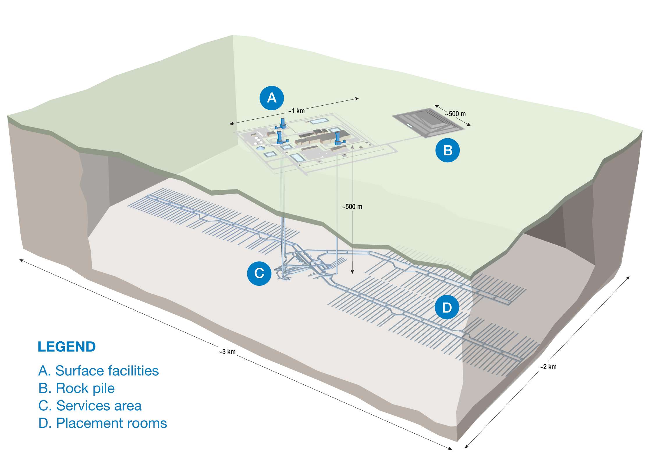
About the Deep Geological Repository (DGR) for Canada’s Used Nuclear Fuel Project
The Nuclear Waste Management Organization (the NWMO) is proposing a new underground deep geological repository system designed to safely contain and isolate used nuclear fuel. Wabigoon Lake Ojibway Nation (WLON) and the Township of Ignace have been selected as the host communities for the proposed project, which is located 21 kilometres southeast of the WLON and 43 kilometres northwest of the Town of Ignace, Ontario along Highway 17. As proposed, the Deep Geological Repository (DGR) for Canada’s Used Nuclear Fuel Project would provide permanent storage for approximately 5.9 million bundles of used nuclear fuel. The project is expected to span approximately 160 years, encompassing site preparation, construction, operation and closure monitoring. The project assessment is being conducted in collaboration with the Canadian Nuclear Safety Commission.
Learn more about the Integrated Impact Assessment process which is led by the Impact Assessment Agency of Canada and Canadian Nuclear Safety Commission.
- Read the Summary of Issues (February 16, 2026)
- Read the Summary of the Initial Project Description (January 5, 2026)
- Read the Initial Project Description (January 5, 2026)
- Learn More about the Melgund Integrated Nuclear Impact Assessment (MINIA) Project
- Learn More about the Nuclear Waste Management Organization (NWMO)