
Digging Deeper into Our Water Quality
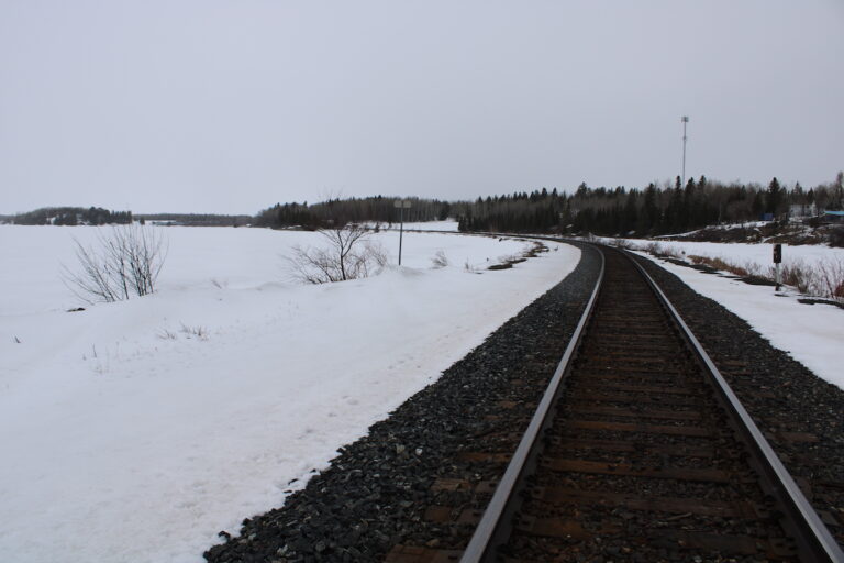
Here in Northwestern Ontario, water isn’t just a resource; it is the lifeblood of our landscape. Whether you are fishing near Borups Corners, relying on a well in Dyment, or enjoying the lakes around Melgund Township, the purity of our groundwater and surface water is non-negotiable. As we look closely at the proposed Revell Site for a Deep Geological Repository, understanding how the water flows beneath our feet is critical. The latest Impact Assessment documents outline how the Nuclear Waste Management Organization (NWMO) plans to study this, but as neighbours, we have a few questions about what is being measured—and what might be missing.
What We Are Learning
To get a clear picture of the environment before any construction begins, the NWMO is conducting “baseline studies.” Essentially, they are taking a snapshot of the water right now so they can track changes later. They are drilling “nests” of shallow wells (up to 100 meters deep) and using deep boreholes (up to 1,000 meters deep) to collect data. By 2024–2025, they plan to feed this data into a computer model to simulate how groundwater moves through the rock. They are also testing water quality quarterly or monthly for metals, nutrients, and general radiation levels.
The Reality Check
While the plan sounds comprehensive on paper, we need to look closer at the details to ensure our community is truly protected.
- What is being promised: A robust computer model of the groundwater system based on data from monitoring wells.
- What we need to verify: The documents don’t show us exactly where all these wells are located or why those specific spots were chosen. Without a map justifying the locations, we can’t be sure the model represents the whole picture or just convenient data points.
- What is being promised: Testing for radionuclides (radioactive elements) to establish a safety baseline.
- What we need to verify: The current plan focuses on “gross alpha and gross beta” screening. This is a broad-brush approach. It might miss low levels of specific, long-lived isotopes that are the real concern with nuclear fuel, meaning the baseline might not be sensitive enough.
The Path Forward
To ensure the safety of Northwestern Ontario, we need to bridge the gap between general plans and specific protections.
The assessment noted a lack of spatial rationale for where the monitoring wells are placed. Therefore, we are calling for the proponent to provide comprehensive maps that explain exactly how the location of these wells corresponds to the repository’s footprint. We need to know if they are monitoring the paths where water is most likely to travel.
Furthermore, the report observed an oversimplification of radiological parameters. Therefore, we recommend expanding the testing suite beyond simple “gross” measurements to include specific isotopes like Iodine-129 and Cesium-137. If we don’t measure these specifically now, we won’t have a true baseline to compare against in the future.
Why It Matters Here
For residents of Melgund Township and surrounding areas, this isn’t just data—it’s about trust. If the groundwater model is built on “cherry-picked” locations, or if the water testing ignores specific isotopes, we lose the ability to detect early warning signs of contamination. Whether you are hunting, running a lodge, or just drinking from your tap, accurate, transparent science is the only way to ensure our lifestyle remains safe for generations.
Have Your Say
This affects our future. Submit your feedback on this specific issue via our Engage page to ensure the Impact Assessment Agency hears from our community.
The Melgund Integrated Nuclear Impact Assessment Project
The Impact Assessment Agency of Canada (IAAC) is reviewing the Nuclear Waste Management Organization’s (NWMO) proposed Deep Geological Repository (DGR) at the Revell Site, located near Ignace and Wabigoon Lake Ojibway Nation in Northwestern Ontario.
This major nuclear infrastructure project is undergoing a joint federal review by the IAAC and the Canadian Nuclear Safety Commission (CNSC) to evaluate environmental, health, social, and Indigenous rights impacts over its projected 160-year lifecycle.
Public Feedback Open: Comments on the Initial Project Description are accepted until February 4, 2026. Submissions help shape the formal impact assessment guidelines.
This short article and summary is based on an initial analysis of a proponent’s initial project description. It does not represent, any community the NWMO or the Government of Canada. Learn more at the Melgund Integrated Nuclear Impact Assessment Project project page.