Understanding Boundaries: Is Distance Enough Protection?
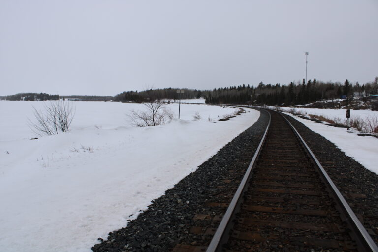
Here in Northwestern Ontario, we often measure distance in driving hours rather than kilometers. The Nuclear Waste Management Organization (NWMO) is looking at the Revell Site near Melgund Township and telling us that because we are a fair drive from the Manitoba border or the United States, the proposed Deep Geological Repository won’t affect our neighbors. But does geography work that simply?
As we review the latest Impact Assessment documents, we need to understand if drawing a line on a map is enough to guarantee safety for the wider region.
What We Are Learning
In their recent submission, the NWMO states that the project will not impact federal lands or environments outside of Ontario. Their reasoning is primarily based on location: the site is over 210 km from the Manitoba border and more than 140 km from the US border. Because of this distance, they claim there will be no changes to the environment across these borders. They also clarify that while the NWMO is federally regulated, the land itself will be private property, not federal land.
The Reality Check
What is being promised: The NWMO asserts that environmental impacts will not cross borders simply because the site is geographically distant.
What we need to verify: Distance on a map isn’t the same as scientific proof. Water flows and atmospheric conditions don’t stop at the 140 km mark just because a line is drawn. We need to verify the actual modeling that proves underground water pathways won’t travel that far, rather than accepting a promise made before the modeling is even finished.
The Path Forward
The technical review identified a significant gap: the NWMO is making definitive claims that impacts “will not” occur before their computer modeling is complete. This feels like putting the cart before the horse.
The Solution: We are calling for the NWMO to adjust their language to “is not expected to” until the science is finalized. More importantly, they need to provide a “conceptual model”—a scientific explanation of the regional rock and water flow—that justifies why 140 km is a safe buffer. Furthermore, the report noted a narrow focus on “Reserve lands.” We are asking the proponent to broaden this to include Indigenous traditional territories and Treaty rights, which often span across provincial borders and require more than just a check on a map.
Why It Matters Here
For residents in Borups Corners and Dyment, we know that our ecosystem is connected. If the modeling is wrong, or if Indigenous traditional territories that cross borders aren’t respected, it creates legal and social headaches for everyone. We need to know that our neighbors in Manitoba and the US are being consulted properly, so we don’t end up in a cross-border dispute that stalls our community’s future or ignores valid concerns about water safety.
Have Your Say
This affects our future. Submit your feedback on this specific issue via our Engage page to ensure the Impact Assessment Agency hears from our community.
The Melgund Integrated Nuclear Impact Assessment Project
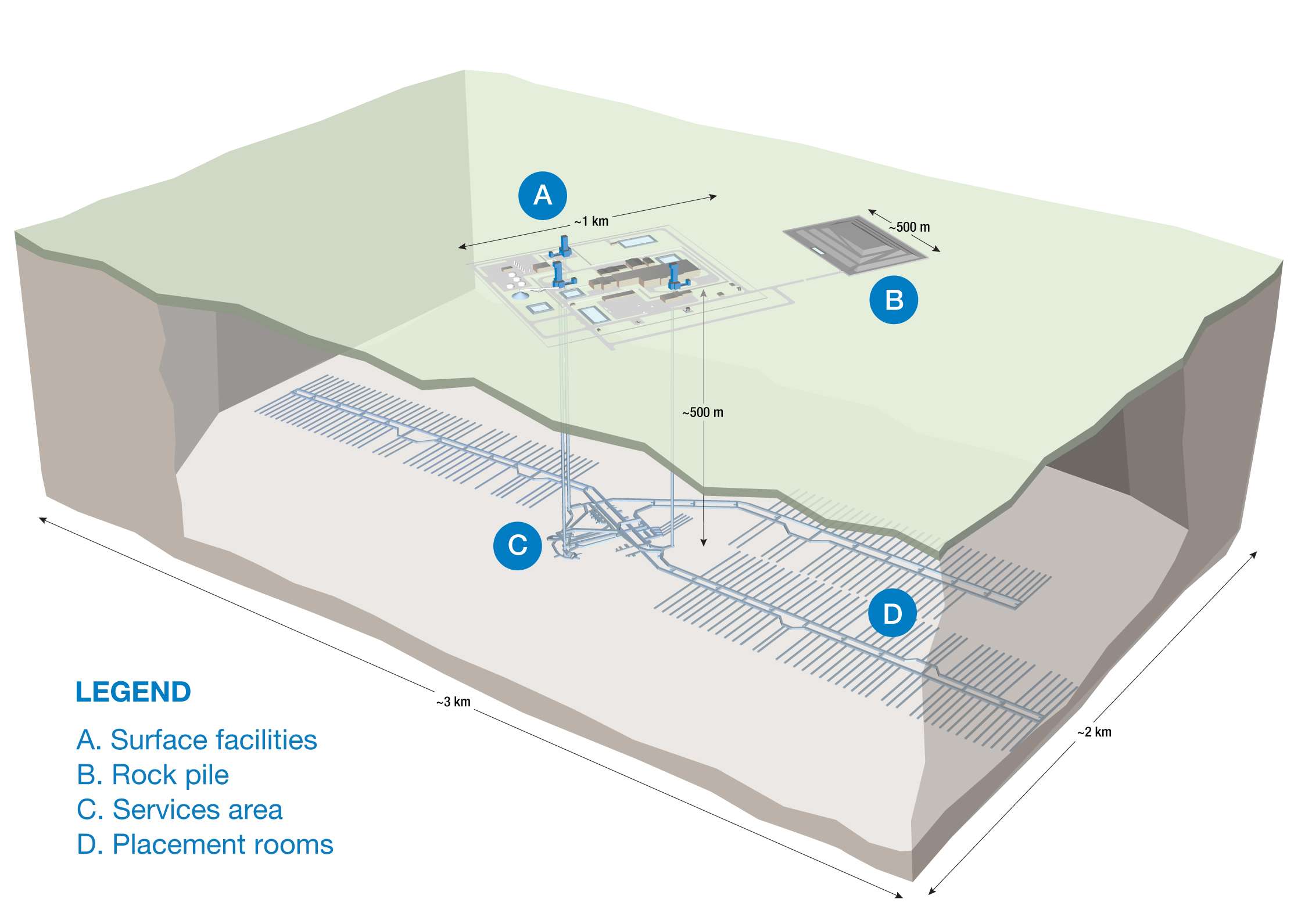
The Impact Assessment Agency of Canada (IAAC) is reviewing the Nuclear Waste Management Organization’s (NWMO) proposed Deep Geological Repository (DGR) at the Revell Site, located near Ignace and Wabigoon Lake Ojibway Nation in Northwestern Ontario.
This major nuclear infrastructure project is undergoing a joint federal review by the IAAC and the Canadian Nuclear Safety Commission (CNSC) to evaluate environmental, health, social, and Indigenous rights impacts over its projected 160-year lifecycle.
Public Feedback Open: Comments on the Initial Project Description are accepted until February 4, 2026. Submissions help shape the formal impact assessment guidelines.
This short article and summary is based on an initial analysis of a proponent’s initial project description. It does not represent, any community the NWMO or the Government of Canada. Learn more at the Melgund Integrated Nuclear Impact Assessment Project project page.