Understanding the Impact on Our Land and Soil
Here in Northwestern Ontario, the granite beneath our feet isn’t just geology; it is the foundation of our landscape. For residents in Melgund Township, Borups Corners, and Dyment, the proposed Revell Site represents a massive shift in how that land might be used. We are taking a closer look at the Nuclear Waste Management Organization (NWMO) latest Impact Assessment regarding the topography, soils, and sediments to understand exactly what physical changes are being proposed for our area.
What We Are Learning
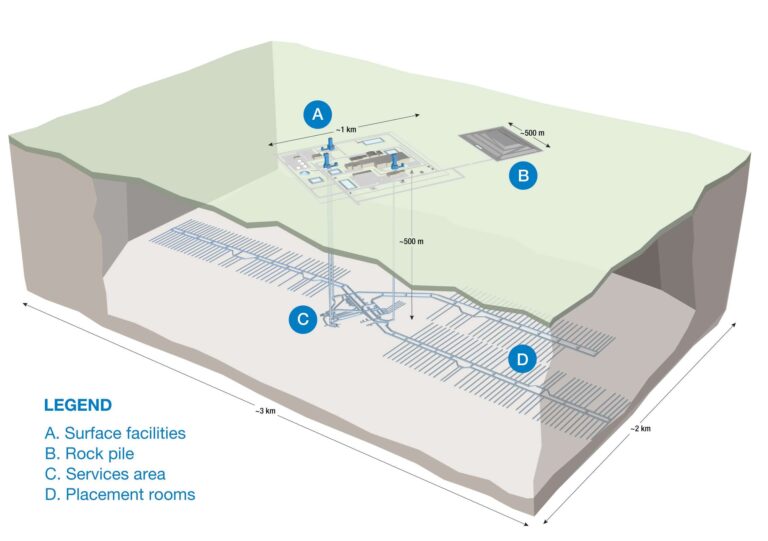
The NWMO’s initial project description outlines significant activity: site clearing, blasting, and the construction of the Deep Geological Repository. They acknowledge that these activities—along with the discharge of treated water—have the potential to change the lay of the land and the quality of our soil and sediment. However, the report suggests that by using standard industry “best practices” and erosion controls, the risk remains low. They also describe our local landscape as “typical of the Canadian Shield,” suggesting that because the terrain is common, the changes to it are less significant.
The Reality Check
While the summary sounds reassuring, a closer read of the technical documents reveals some details that need clarification.
- What is being promised: The report claims that mitigation strategies (like sediment fences and water management) are “well-established” and will effectively prevent damage to the surrounding environment.
- What we need to verify: We need to see the proof. The report relies on general assertions rather than providing case studies of similar large-scale blasting projects in this specific type of terrain.
- The Data Confusion: In a confusing oversight, Table 19.11 in the report is titled “Surface Water Quality,” yet the text claims it presents the risk assessment for soils and sediment. This labeling error makes it difficult for us to know if we are looking at the right data for the ground beneath our feet.
The Path Forward
To ensure the safety of the Revell Site, we need to bridge the gap between general promises and specific local protections.
The Gap: The report dismisses the local topography as “typical,” and uses the vague term “natural variability” when discussing potential contamination in sediments.
The Solution: We are calling for a detailed, site-specific topographical survey. We cannot rely on regional generalizations; we need to know if specific local ridges or depressions that matter to local drainage or wildlife are at risk. Furthermore, we need hard numbers—quantitative baseline data—defining what “natural” soil chemistry looks like here before any digging begins.
Why It Matters Here
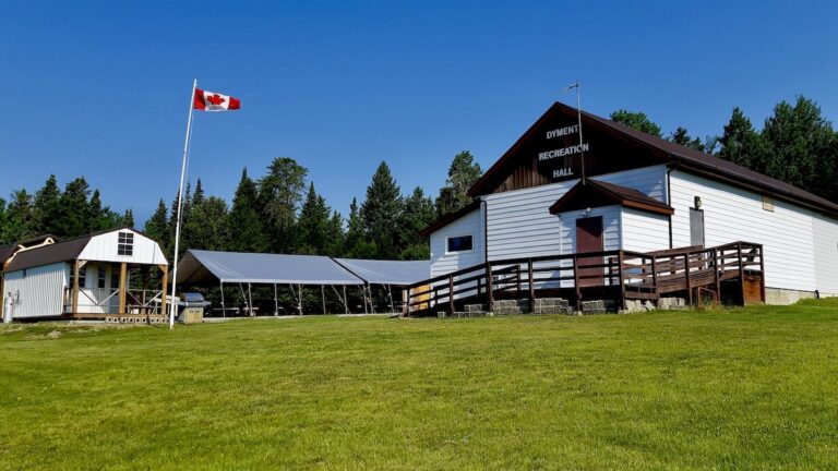
For families in Melgund Township and surrounding areas, this isn’t just about dirt and rocks. “Sediment mobilization” is a technical term for silt clouding the creeks where we fish. “Fugitive dust” is what lands on the berry patches we harvest. When the report calls our home “typical,” it risks overlooking the unique nooks and crannies of the land that locals know and value. Ensuring the data is accurate—and the tables are labeled correctly—is the minimum requirement for a project of this magnitude.
Have Your Say
This affects our future. Submit your feedback on this specific issue via our Engage page to ensure the Impact Assessment Agency hears from our community.
The Melgund Integrated Nuclear Impact Assessment Project
The Impact Assessment Agency of Canada (IAAC) is reviewing the Nuclear Waste Management Organization’s (NWMO) proposed Deep Geological Repository (DGR) at the Revell Site, located near Ignace and Wabigoon Lake Ojibway Nation in Northwestern Ontario.
This major nuclear infrastructure project is undergoing a joint federal review by the IAAC and the Canadian Nuclear Safety Commission (CNSC) to evaluate environmental, health, social, and Indigenous rights impacts over its projected 160-year lifecycle.
Public Feedback Open: Comments on the Initial Project Description are accepted until February 4, 2026. Submissions help shape the formal impact assessment guidelines.
This short article and summary is based on an initial analysis of a proponent’s initial project description. It does not represent, any community the NWMO or the Government of Canada. Learn more at the Melgund Integrated Nuclear Impact Assessment Project project page.